Tuesday, March 10, 2020

Grandson Conquers Mount Cammerer

Check one destination off Jacob's bucket list! Saturday morning he met up with Uncle Noel to hike to Mount Cammerer Lookout Tower via the Low Gap Trail out of Cosby, an 11-mile in-out hike. The temperature starting in the low 40s and prediction for sunny weather guaranteed a perfect day for hiking in the Smokies. 
Although the valley had received a slight dusting of snow a few days before, the higher elevations measured snow and ice in inches.
The hike to Mt Cammerer is not for the faint-hearted. The trail is a steep, relentless 3-mile climb of more than a 2000-foot elevation gain to the Appalachian Trail. From the junction with the AT, it's another 2.5 miles of hiking to reach the spur trail leading to the tower. 
What could possibly explain these mysterious threads of ice pushing up through the frozen ground? The crystals are as delicate and thin as spun sugar. Could they be remnants of a recent battle between mountain fairy forces? Or perhaps they were the slag scraps from mountain troll mining! Or maybe they were fairy sugar farms providing sweet floss for fairy herds. None of the above! This phenomenon is actually called "needle ice." Scientifically explained, it  occurs in loose sandy soils when water in the soil moving in a capillary action from the warmer ground reacts to freezing air temperatures. The moisture in the ground gets sucked upward through tiny ice tubes freezing upon contact with frigid air. As more water is drawn up, it freezes and pushes the newly formed needles of ice outward creating long strands of fragile ice crystals. 
 The higher the trekkers climbed, the more ice rime and snow they encountered.  
 Rhododendron tunnels became ice palaces.
The ice rime gleamed and glittered in the sunlight.
 The destination is up there somewhere off to the left, a considerable climb to reach the AT and then the spur trail leading to the tower. 

The 0.6-mile spur trail to the tower passes through some intimidating rock formations. During warm months, the hiker must be observant to look and listen for timber rattlers.
Perched on the edge of the rocky cliff, the Mount Cammerer tower provides an awe-inspiring, panoramic view of the valley and mountain range upon mountain range. 
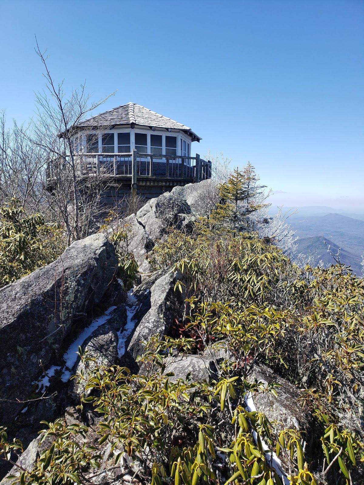
 The view from Mt Cammerer is worth the strenuous workout!
 Uncle Noel climbed out to the edge of the rock formations, a great spot to eat lunch.
 The rugged terrain reaching into North Carolina stretches for miles.
 The lookout tower is spectacular regardless of the camera angle. 
 The guys decided to return via the Lower Mount Cammerer Trail expecting the longer trail to be gentler on the knees. However, this added 5 more miles to the hike; thus, the round trip was 16.1 mile loop rather than the 11.2 in-out [or up-down] miles! 
They stopped by the Phillips' cemetery located near Groundhog Ridge on their way down via the Lower Mount Cammerer Trail.
Riding Fork Creek cascades down a long mossy rock formation. Just past the the creek crossing the hikers experienced their last serious climb and passed the Sutton Overlook spur trail. Ahhh, afterwards a wide, gently rolling trail led them back to their vehicles.  
  I enjoyed vicariously revisiting the hike to Mt Cammerer although when I hiked it, I was much younger. I asked Jacob if the pain was worth the reward. He certainly thought so. Now, on to the next destination on his bucket list! 

Tuesday, February 18, 2020

Henwallow Falls

Hiking to Henwallow Falls, Cosby
After being cooped up in the house for a week due to excessive rain, today provided a perfect opportunity to go hiking in the Smokies. Temperatures ranged from mid-morning 40s to afternoon 60s. So, the Grands and grandson Jacob headed for Cosby to hike to Henwallow Falls. From the traffic on this trail, many other hikers had the same idea. Couples, families, singles, young and older could not resist getting out on such a gorgeous February day. 
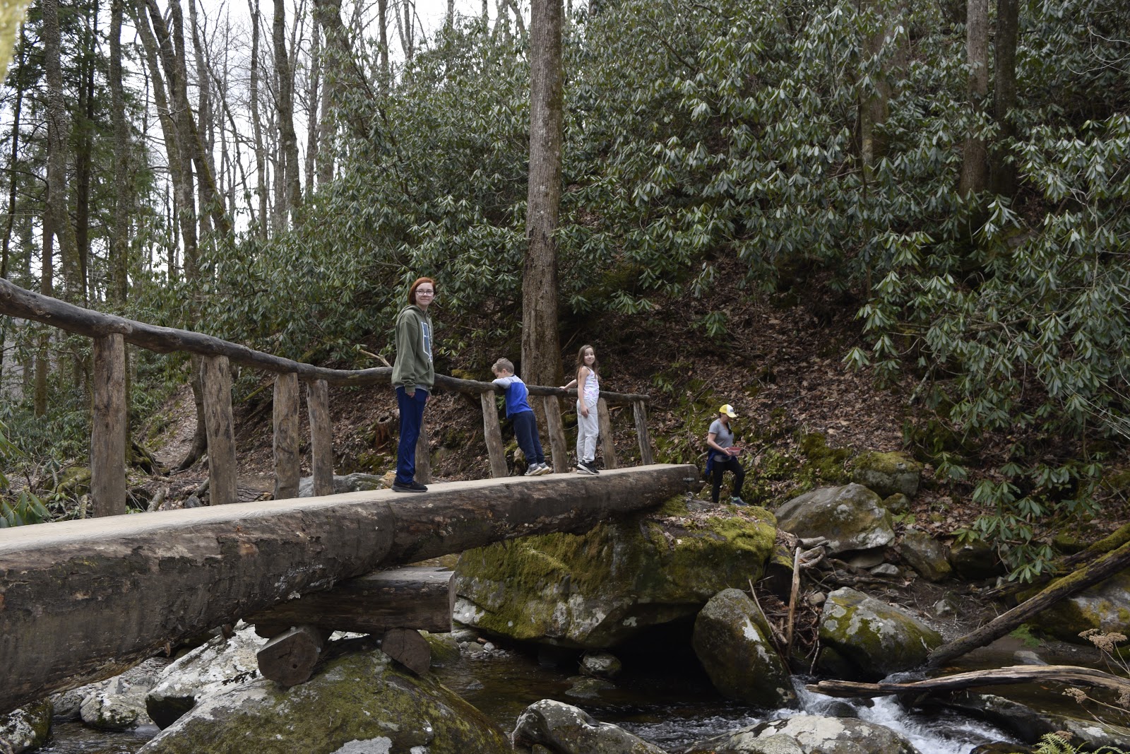
 For the most part, the trail is up but it is a popular well-maintained trail. It had been several years since I had hiked to the falls. What struck us about the trail was the quality, sturdiness and design variety of the bridges which crossed some major streams. 
 With all the rain we've had this past winter, we didn't know quite what to expect about stream crossings. 
 We wondered who the bridge engineers were who were so very thorough in the bridge construction. Below you can see how wide and sturdy is the footbridge and the care taken with the accesses. Very impressive!
 The design pictured below is a first for us to experience in the Smokies. A bridge of tightly packed stones like a wall with 2 metal culvert pipes for water flow gives "rock hopping" a new definition. Very creative! And convenient!
The trail passes through stands of imposing mature hemlocks and tulip trees. On the backside of many of the hemlock trees we noticed paint marks, an indication that the trees have been treated for woolly adelgid.  I'm glad these noble, majestic trees are being monitored in attempts to save them. 
 What appeared to be a clearing for a former turn-around [similar to one at Ramsey's Cascades Trail before the narrow, rocky trail takes a sharp left to head parallel to the stream] opened up the canopy. We saw the remnants of the old road that used to come up from Cosby Road. 
 The spur trail that veers off to the right leads the hiker 0.1 mile steeply down to the base of the falls. 
 After significant rainfall these past few days, the falls were full and vigorous. More of a cascade gliding down a huge rock cliff, Henwallow Falls was impressive this day...and also a popular destination. 
 Our trio posed for a friendly hiker to snap our picture.
 The section of trail approaching the spur trail edged along a high bluff offering vistas of the the valley below. 
 Peanut butter and honey sandwiches are a satisfying lunch on a Smokies hike. 
 Jacob and I were rewarded with this view across the Cosby valley when we decided to satisfy our curiosity about checking out the view from above the falls.
 Rhododendron thickets, moss and large trees characterized sections of the trail. 
 It was an easy approach to the top of the falls, but we could only capture a glimpse of the water shooting off the top. This creek is Lower Falling Branch which feeds into Henwallow Creek farther down the mountain. 
 On our return we found the small side trail through thick rosebay rhododendron that leads to the single grave of Sally Sutton. According to a couple of sources, Sally Grooms Sutton farmed in the area where her grave is located. Also, the sources claim that her baby daughter Jennifer was buried nearby. 
 Jacob could not resist the opportunity to log balance.
 Our last bridge before reaching the vehicle served as a pleasant reminder of a spectacular day spent in the Smoky Mountains. 
For those who are curious about how "Henwallow" received such an unusual name, you will chuckle at the sense of humor mountain folks expressed. Who better to relate the background of this moniker than Carson Brewer, the consummate story teller, who preserved mountain stories in his Hiking in the Great Smokies. Henwallow is the name one community gave another as an act of spite. A man reportedly purchased 100 baby chicks to raise to become egg-laying hens and thus provide income. When the chicks matured to where they could be sexed, he discovered that the batch contained 95 roosters and 5 hens. The people living in the community below the falls thought the story so humorous that they nicknamed their neighboring community "Rooster Town." In retaliation for the mocking, the Roostertown folks named their neighboring community "Henwallow." Ah, the creativity of mountain folks! 

Thursday, February 6, 2020

Charlotte's Birthday Hike

Destination: Giant Trees on Ramsey Prong
What a treat when a grandchild agrees to spend time on a hike with the Grands! Early February has been unseasonably warm with spring-like weather offering the perfect opportunity to hike in the Smokies. Our daughter Emily, who is an avid hiker, runner and cyclist, suggested to her 5 that a mountain field trip would be a great way to spend the day. 
 With the temperatures expected to be in the upper 60s, Grand-Dad suggested that we head to Greenbrier to hike Ramsey Cascades Trail to the giant Tulip Trees. 
 For the first 1.7 miles, the trail follows the old road which the Park closed sometime in the 70s. 
 Who can miss an opportunity to perform on a giant rock?
 Log lizards being silly on one of several blowdowns.
 Thankfully for the Grands there were benches at the end of a hard pull up the mountain!
 Jordan, our 5-year old grandson, never slowed down. He found lots of "swords" and "spears." I especially enjoy watching the wonder on the grandchildren's faces when they find rocks, sticks, bobcat scat, mushrooms and other interesting features on their adventures in the Smokies.  
 The former turn-around was the perfect spot to eat lunch.
 At this point on the hike, the trail takes a left turn to follow the course of the Ramsey Prong. The trail begins a steep climb and becomes more rugged as the "gorge" narrows. We had to navigate rocks, roots, blowdowns and streams. 
 Birthday girl enjoying a moment beside the stream!
 Griffin was fascinated by the lumpy growths he spotted on trees and rhododendron. 
 What little boy can resist climbing?
 It takes a lot of strength to push over a massive tree.
 Once we reached the foot bridge that crosses Ramsey Prong, we knew the trail was going to get very steep. I am thankful that the Park replaced the old washed-out bridge with a wide sturdy one. The old bridge, which washed out a couple of years ago, was a very narrow bridge perched high over the gorge downstream from the current one. The old bridge was scary to cross!  
Our reward! The kids could not believe the size of the trees and were eager to wrap their arms around the solitary giant to see how many of us were required to touch finger tips. Six! A math lesson ensued and we determined that the tree was more than 22 feet in circumference and more than 7 feet in diameter.  

Wonder of wonders! Two giants stood sentinel over the trail which passed between them. 
 During winter when the foliage does not block views, you can see other very large trees scattered up the Ramsey Prong watershed. They are often easy to spot because their huge branches not only dominate the forest canopy but their limbs are as big as mature trees. Awesome wonders!
 This youngster never got tired of wandering and climbing. One would expect a 6-mile hike to weary a 5 year old! 
 What can beat a glorious day in the Smokies with grandkids who love hiking?