COVID was not going to dampen our 50th wedding anniversary celebration, December 27! Chris chose a lovely location for us to spend a couple of days, the Historic Olde Mill Inn Bed and Breakfast at Cumberland Gap, TN.

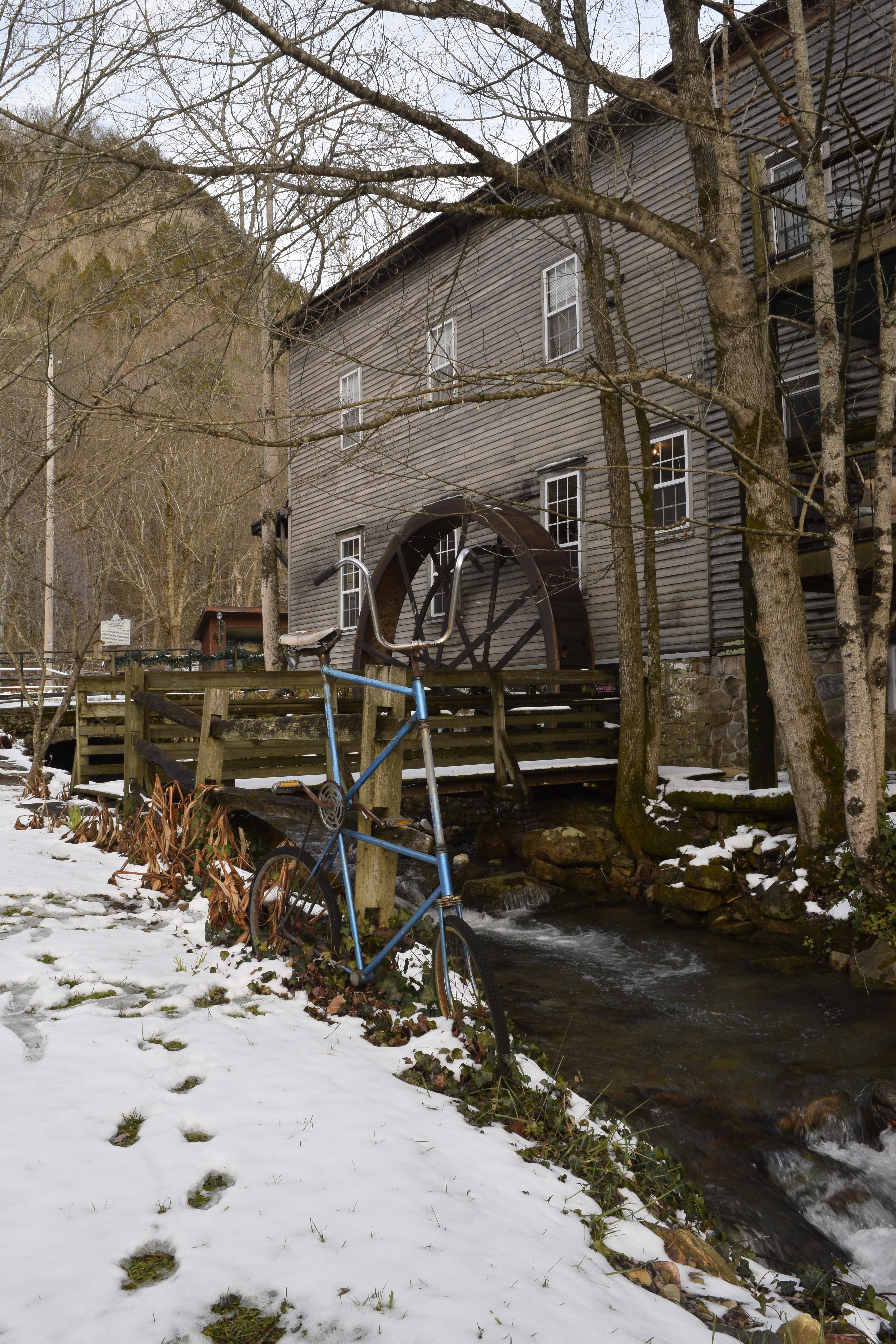
We enjoyed a white Christmas at home, but we were still pleased to see snow all around the Gap. The inn had been a working mill dating from the mid 1800s. Beside the mill and part of the inn was an authentic log cabin dating from the 1700s. The Cumberland Gap area is rich in history.

The staff at the inn assured us that we would experience a contact-free stay. Masks were required during times we were not in our room. Our host announced our breakfast when he placed our delicious meal just outside our door. Breakfast was served on fancy disposable platters. However, the room was equipped with amenities such as a Keurig with coffees, teas and snacks.

A punch code guaranteed security. Our room was immediately up a long flight of stairs.

Gap Creek which flows out of Gap Cave provided the water power to drive the huge water wheel at the mill. Actually the spring's water is bottled in Middlesboro, KY. Cumberland Gap Spring Water is by far the best tasting bottled water!

The creek still provides water for the towns of Harrogate and Cumberland Gap.

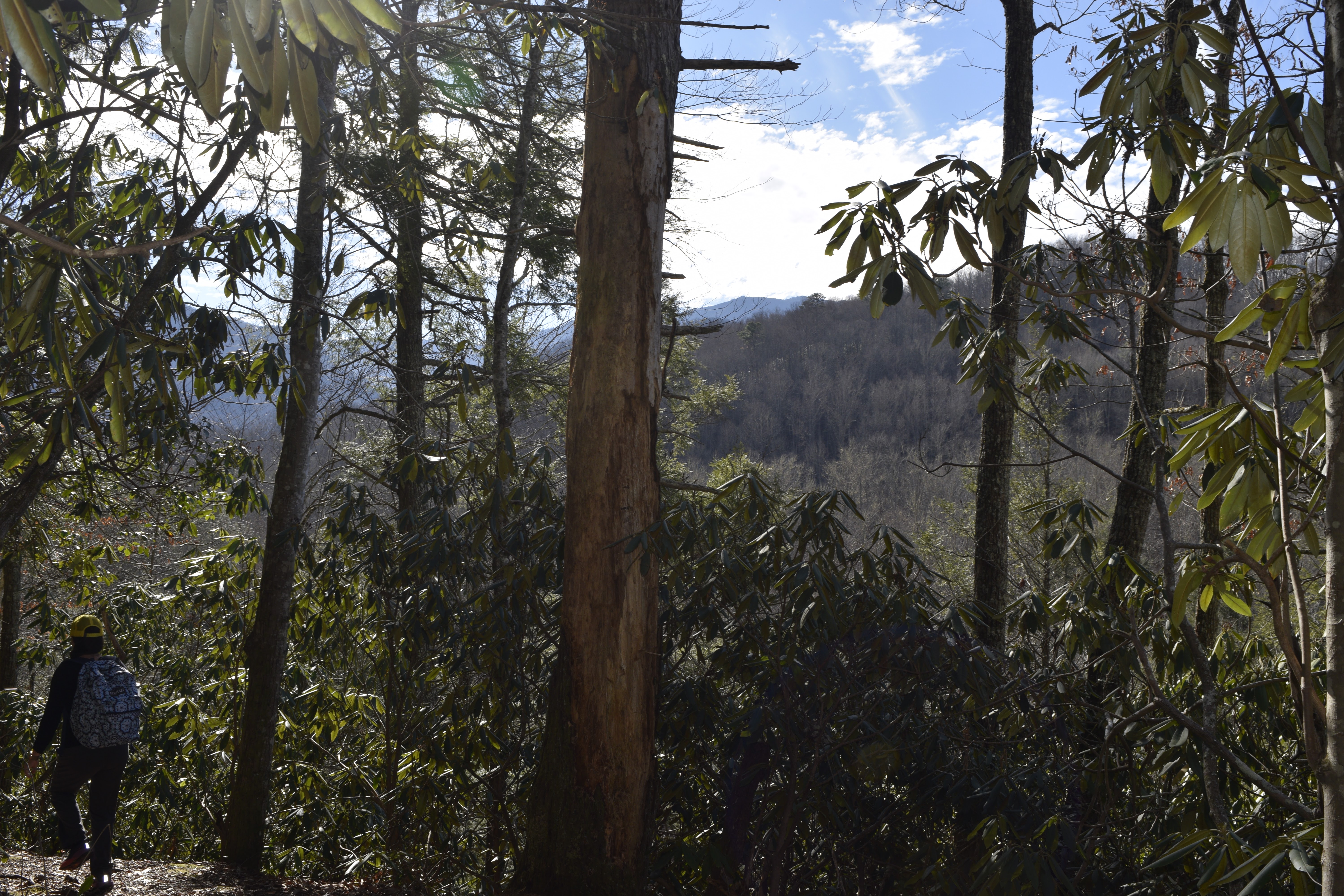
As the day warmed up a bit, we decided to take a walking tour to explore the town. Around the corner and down the block is a quaint bicycle museum, unfortunately closed.


Our room had a very large window with a breathtaking view of the Pinnacle, thus appropriately giving our room its name "The Pinnacle." Unfortunately the road leading up to the overlook was closed due to ice and snow.

Our anniversary dinner was served in our room on a tiny round table. Chris got us both laughing with hilarity at his comment, "I would have made this a candlelight dinner but there's no room on the table for candles." No problem! Gondolier's dinners are delicious whether served in styrofoam or aluminum!

I imagine the patios and gardens are alive with laughter and music during the summer. Or were alive with activity before COVID.

A stroll around the town along a greenway took us near a train track and tunnel. I don't believe the rail line is active today, but it would be interesting to walk through the tunnel under the Gap to emerge on the other side in Kentucky. Of course, you would have to carry flashlights or wear head lamps. We could not see light at the end of this tunnel. According to the pamphlet Seeing Towne of Cumberland Gap KY. Tenn. VA. An Official Guide, "the tunnel was hand-carved by Italian emigrants 3,746 feet portal to portal which was completed under budget and ahead of schedule. Many of their descendants live in the area today-Circa 1897."

Since we had in days past explored the Tri-state point, the iron furnace and the Wilderness Road, we made a mental note to return with grandchildren for a "field trip." The pamphlet claims that another nearby tunnel, now part of the greenway, was "converted to pedestrian travel and [is] ADA approved." Yep, a warm weather field trip!

The greenway paralleled the railroad tracks for a while and split off to pass through a covered bridge along an old railroad spur above the creek and lower greenway.

A second covered bridge down the greenway passed over the road.

I love photographing quaint small-town post offices. The Cumberland Gap Post Office is in a very picturesque setting.

A store creatively displayed a scene with Scrooge from A Christmas Carol.

Historic signs offer helpful information.

The sign reads: CUMBERLAND GAP First explored in 1750; Long Hunters used it until 1760, and Daniel Boone in1769, cutting the Wilderness Trail through it in 1775. Hosts of pioneers followed even before the road was built in 1796. Postal service was established in 1795 and a post office in 1803. The Gap changed hands 4 times during War Between the States.

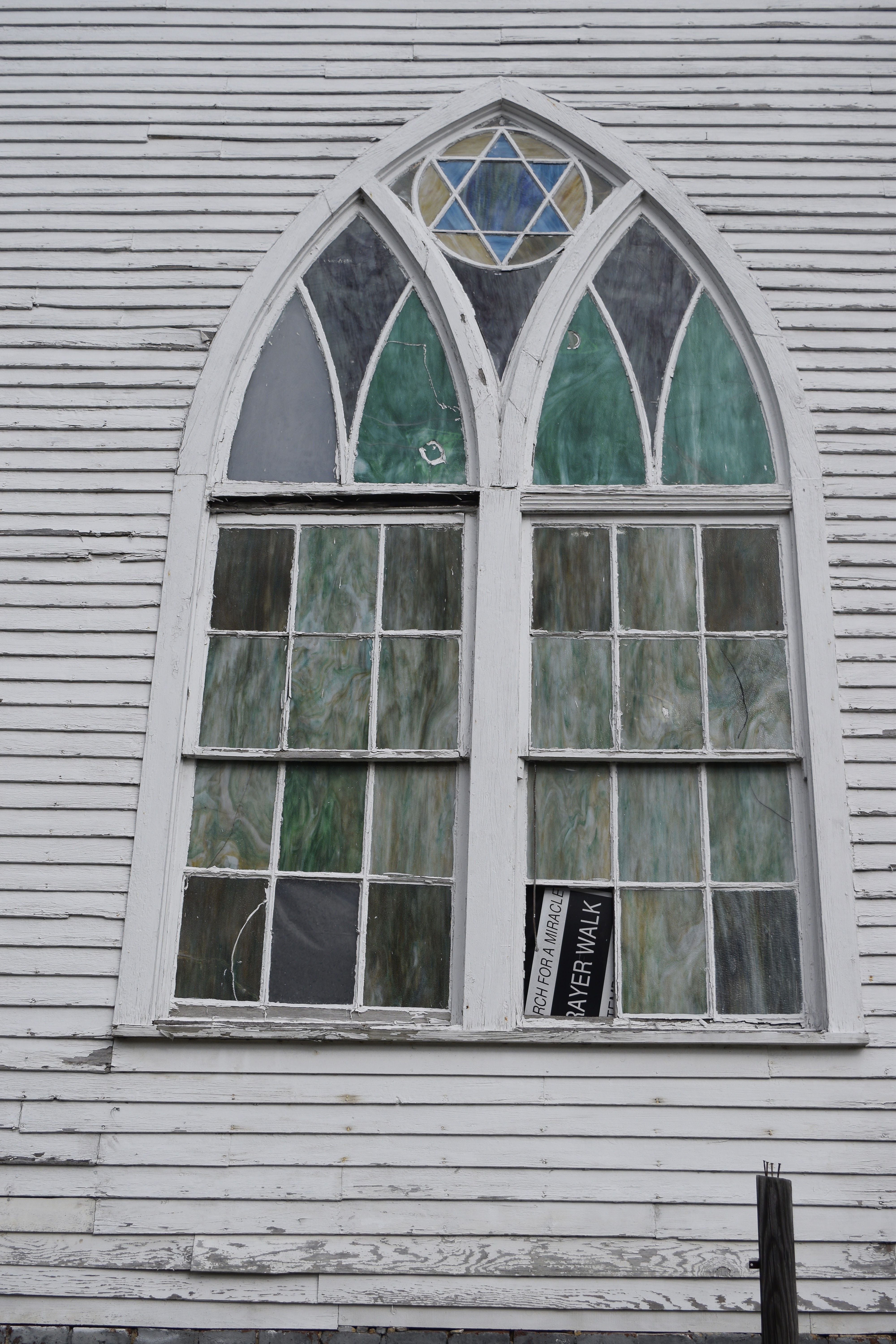
Sitting on a corner of Pennlyn Street was an unidentified church building. Its architectural design reminded me of the Congregational church buildings in New England especially in Vermont. Sadly, it had a For Sale sign posted in its yard.

But what a lovely location beneath the towering escarpment and Pinnacle!

We were quite stunned by a vigilant guard dog at the back of the church. After recovering from my initial fright, I inspected the creature up close only to discover it was a concrete objet d'art.

A Star of David holds a prominent place in the window.
As our walking tour brought us back to the Inn, the Snow Queen posed for a photo.

What fun! Two friends searched for spots to do a photo shoot.

After our tour of the town, we returned to the inn for lunch.

Another historical marker explained the intersection of three states 1 1/2 mile up the ridge: Tennessee, Kentucky and Virginia. In 1779 Dr. Thomas Walker and Colonel Richard Henderson surveyed the boundaries. However, the boundaries were not permanently fixed until a Supreme Court decision in 1903 finally approved the current location.

The afternoon promised to be warmer with more sunshine. So, we drove through the tunnel into Kentucky to visit the other side of Cumberland Gap National Historic Park. We took a circuitous route through the park passing scenic natural beauty along a river and then circling back into Middlesboro. With daylight to spare, we returned via the tunnel but drove to Wilderness Road State Park in southwest Virginia, just 7 miles from the town of Cumberland Gap.
Santa greeted us at the fee station.

Martin's Station is nestled at the base of the Cumberland Mountain range. Stations were forts established along the Wilderness Road for travelers to have shelter and safety along their journey. They were often scattered along major roads every 10 miles or so.


Captain Joseph Martin established the fort in the spring of 1775. The station played a key role in the settlement of the American West.
The frontier station was painstakingly re-created by archaeologists and researchers. They used authentic tools of the time along with native materials to accurately depict the structures and layout of the fort.

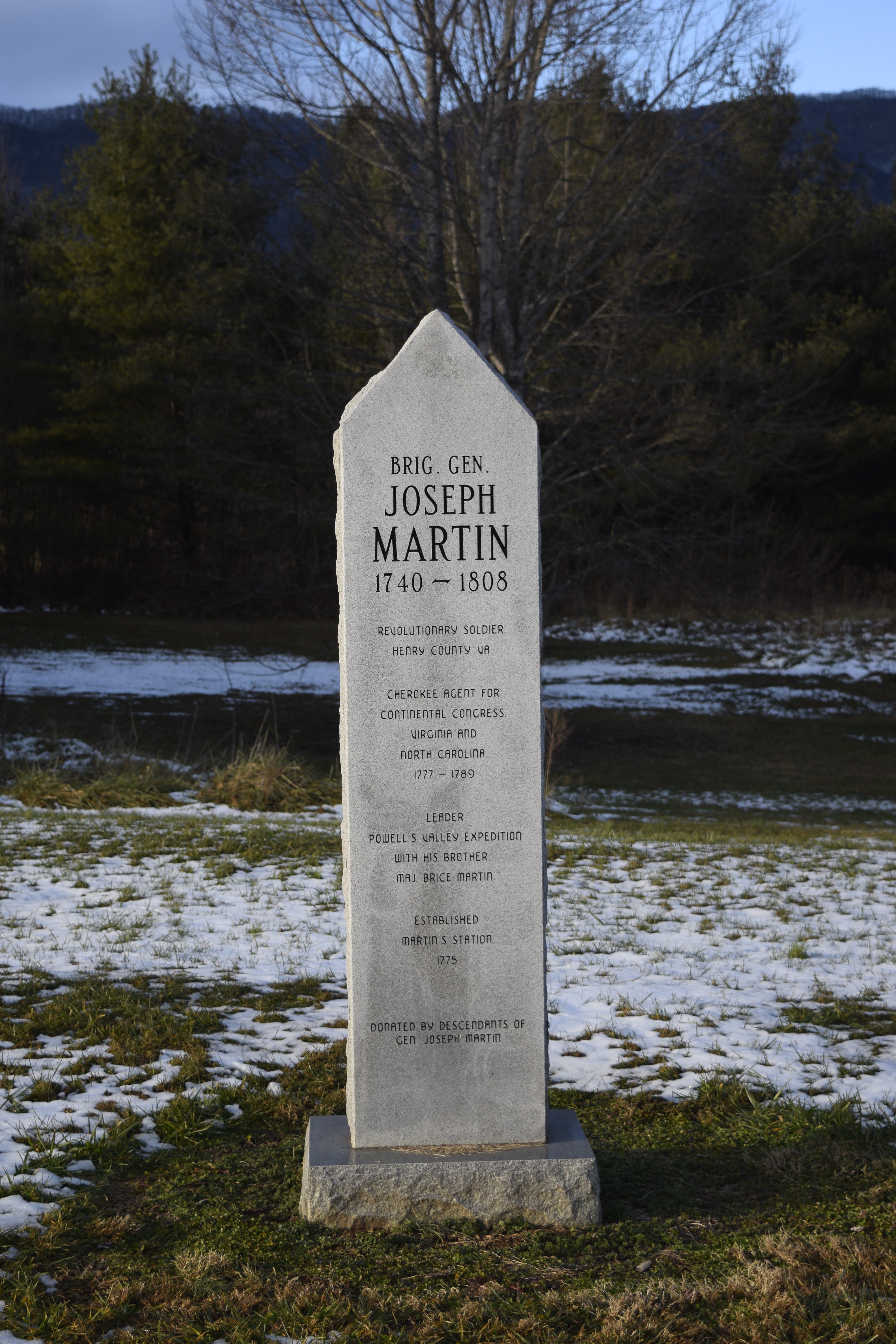
A tribute marker stood sentinel honoring General Joseph Martin and the 200,000+ settlers "whose courage and fortitude helped to carve our great nation out of a vast wilderness."

Split rail fences guide the visitor to come see history!

Martin's Fort, although today a re-creation, was located on the north side of the Martin's Creek at the base of the Cumberland Mountains. Originally there were 5 or 6 cabins 20 feet apart with strong stockades between. Port holes strategically placed allowed for soldiers or sharp-shooters to keep watch.

The original "station contained about half an acre of ground. The shape was a parallelogram." --Capt. John Redd, 1775


The historians researched the exact method for hewing logs for buildings so they could replicate the architecture of the 1700s. Mud, straw and grass waddle provided the chinking between logs.


Vegetable gardens provided local produce.

During the season costumed interpreters depict the lives of the men and women who traveled the Wilderness Road.

The spring house protected the water source from contamination.


After a full day of exploring the area, we returned to the inn. 

What a lovely way to celebrate 50 years married to a most remarkable man!
December 27, 1970-December 27, 2020.