Check one destination off Jacob's bucket list! Saturday morning he met up with Uncle Noel to hike to Mount Cammerer Lookout Tower via the Low Gap Trail out of Cosby, an 11-mile in-out hike. The temperature starting in the low 40s and prediction for sunny weather guaranteed a perfect day for hiking in the Smokies.
Although the valley had received a slight dusting of snow a few days before, the higher elevations measured snow and ice in inches.
The hike to Mt Cammerer is not for the faint-hearted. The trail is a steep, relentless 3-mile climb of more than a 2000-foot elevation gain to the Appalachian Trail. From the junction with the AT, it's another 2.5 miles of hiking to reach the spur trail leading to the tower.

What could possibly explain these mysterious threads of ice pushing up through the frozen ground? The crystals are as delicate and thin as spun sugar. Could they be remnants of a recent battle between mountain fairy forces? Or perhaps they were the slag scraps from mountain troll mining! Or maybe they were fairy sugar farms providing sweet floss for fairy herds. None of the above! This phenomenon is actually called "needle ice." Scientifically explained, it occurs in loose sandy soils when water in the soil moving in a capillary action from the warmer ground reacts to freezing air temperatures. The moisture in the ground gets sucked upward through tiny ice tubes freezing upon contact with frigid air. As more water is drawn up, it freezes and pushes the newly formed needles of ice outward creating long strands of fragile ice crystals.

The higher the trekkers climbed, the more ice rime and snow they encountered.

Rhododendron tunnels became ice palaces.

The ice rime gleamed and glittered in the sunlight.

The destination is up there somewhere off to the left, a considerable climb to reach the AT and then the spur trail leading to the tower.

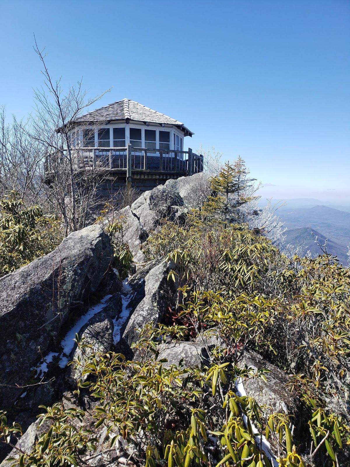
The 0.6-mile spur trail to the tower passes through some intimidating rock formations. During warm months, the hiker must be observant to look and listen for timber rattlers.

Perched on the edge of the rocky cliff, the Mount Cammerer tower provides an awe-inspiring, panoramic view of the valley and mountain range upon mountain range.

The view from Mt Cammerer is worth the strenuous workout!

Uncle Noel climbed out to the edge of the rock formations, a great spot to eat lunch.

The rugged terrain reaching into North Carolina stretches for miles.

The lookout tower is spectacular regardless of the camera angle.

The guys decided to return via the Lower Mount Cammerer Trail expecting the longer trail to be gentler on the knees. However, this added 5 more miles to the hike; thus, the round trip was 16.1 mile loop rather than the 11.2 in-out [or up-down] miles!
They stopped by the Phillips' cemetery located near Groundhog Ridge on their way down via the Lower Mount Cammerer Trail.

Riding Fork Creek cascades down a long mossy rock formation. Just past the the creek crossing the hikers experienced their last serious climb and passed the Sutton Overlook spur trail. Ahhh, afterwards a wide, gently rolling trail led them back to their vehicles.

I enjoyed vicariously revisiting the hike to Mt Cammerer although when I hiked it, I was much younger. I asked Jacob if the pain was worth the reward. He certainly thought so. Now, on to the next destination on his bucket list!
No comments:
Post a Comment