An intriguing blogpost whetted our curiosity about a waterfall off a segment of the Cumberland Trail near Dayton. Our first comfortably warm day in more than a week offered an opportunity to do some exploring. So Chris, his brother J and I drove to hike the McGill Creek segment of the Cumberland Trail located just outside Graysville, TN to begin our trek. The drive would take about 1.5 hours so there was no need to get an early start when the temperature was hovering in the mid-20s. But the weather forecast called for highs in the upper 40s with plenty of sunshine. Perfect hiking weather!
We arrived at the parking area, collected our gear, changed into hiking boots, layered our clothing and began our hike. Rather than cutting through the woods per map, we walked along Brayton Mountain Road a bit, crossed the bridge over Roaring Creek and picked up the trail. Our intention was to do an in-out hike of about 5+ miles.
Heading out of the parking area, we kept hearing unfamiliar "gurgly chortling" noises all around us. At first we suspected guinea fowls. But J spotted a V-formation circling above us and readily identified the source of our noise: Sandhill cranes! When he and his wife JL lived in Florida, they became quite acquainted with this strange waterfowl. Then we all three recalled that we were in the area where this endangered bird winters. What a treat!

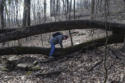
The first part of the trail follows an old road bed, perhaps an old logging road. We encountered a couple of blowdowns, but otherwise the trail was wide and well-maintained until...
...the trail became steep and rocky. Kudos to the Cumberland Trails Conference folks responsible for building the trail. The drainages had well-placed, large, secure stepping stones.
The first mile of the trail had some very steep places requiring stone steps.
The trail wound around boulders and across stream beds.
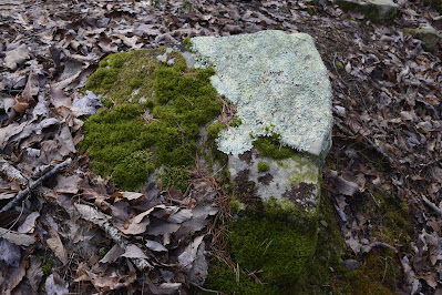
Although spring wildflowers are still several weeks away, you can always find something interesting in the woods. Rocks covered with mosses and lichens create intricate patterns.
J led the way.
Chris followed. For this portion of the trail, we were hiking above Brayton Mountain Road, a winding road that made switchback turns up the mountain. Just to our right we began to see the long guardrail on a switchback.
We came off that section, crossed Brayton Mountain Road at a hairpin turn and picked up the trail. This portion of the trail offered incredible views across the valley. We had previously learned that you can park at a pull-off to hike this portion thereby avoiding the mile trek through the woods. However, Chris wanted the full experience so he could claim that he had hiked this segment.
The trail from this point until we reached the bridge at McGill Creek was an old logging road or former ATV trail. Leaving the road behind us, we could no longer hear traffic sounds. However, the melancholy sound of a train whistle down in the valley followed by the deep rhythmic rumbling reached us up on the side of the mountain. By noon we welcomed the warm sunshine! Until we reached the valley floor where we crossed a small stream, the trail was wide enough for us to walk side-by-side. The gentle up soon became a long gentle down. Pleasant weather, pleasant company, pleasant trail.
We reached the flat area near McGill Creek, crossed a small side stream and hiked along McGill Creek until we came to the bridge.
I always marvel at how the trail crews manage to construct elaborate sturdy footbridges in wilderness areas!
The stream was flowing with plenty of water, so we knew the falls would not be disappointing.
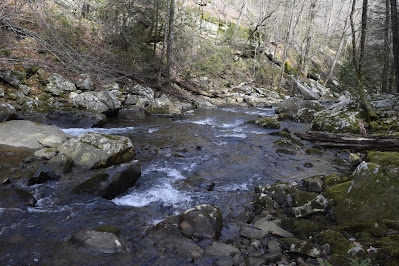
It provided a perfect spot to eat lunch. Streams that flow out of the pocket wildernesses are lovely with the boulders, cascades, small waterfalls and pools of still quiet water.
We expected the falls to be about a quarter mile upstream past the bridge but we also knew that the trek would be challenging...especially for two septuagenarians (aka folks in their 70s). J was the youngling!
From this point there is not much relief because we had to climb up, then down, then up and then down again.
McGill Creek is a beautiful stream tucked into the gorge and tumbling down through boulders and over ledges.
After we crossed the bridge and began the ascent, the trail lacked blazes so we had to rely on survey tape and rock step patterns to determine the course. The segment of the Cumberland Trail past the bridge is not officially open. Although the trail crew had managed to arrange sturdy flat boulders into steps, we often had trouble determining the trail through the boulder field.
At this point we are high above McGill Creek as we maneuver across and through huge jumbled-up rocks. We could see the falls far off ahead. Maneuvering through the rocks and climbing ever higher, we anticipated reaching our destination.
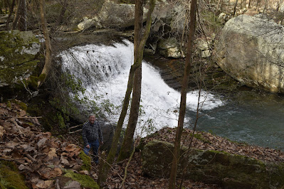
A spur trail marked with blue survey tape points the way down to the falls. It's a steep drop to the falls!
J stands near the base to provide perspective on the size of the falls.
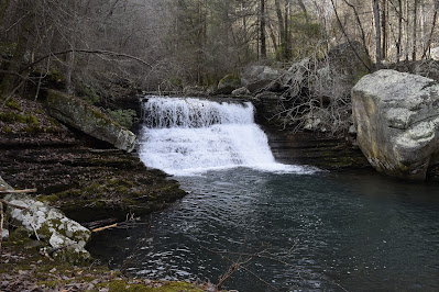
Although we saw no easy way to get to the base of the falls in order to get a good photo, J and I scooted down the slippery bank, stepped along the narrow rock shelf ledges and managed to find a good spot to shoot the falls.
The best shot would be from the middle of the stream, but February is not a good time to wade in a mountain stream!
The return trek was treacherous for me because my knees were in rebellion and didn't want to step down any more! Also, we older folks have a balance issue that makes us super cautious in unstable situations.
At last we spotted the bridge!
A moment to celebrate, catch our breath and head back to the trailhead! What an achievement for 2 old hikers!
To top off a perfect day, JL welcomed us with a hearty roast beef dinner with all the fixin's: carrots, potatoes, green beans and for dessert biscuits and homemade apple butter.









No comments:
Post a Comment