Pisgah National Forest Excursions
Knoxville temperatures were predicted to be in the upper 90s. So, what better opportunity to head to higher ground, Pisgah National Forest.
We took I-40 E to the Harmon Den exit and headed up the gravel road to Max Patch. The parking lot had only a few cars so we felt like we had the mountain all to ourselves.
The Carolina Mountain Club has installed a
new kiosk.
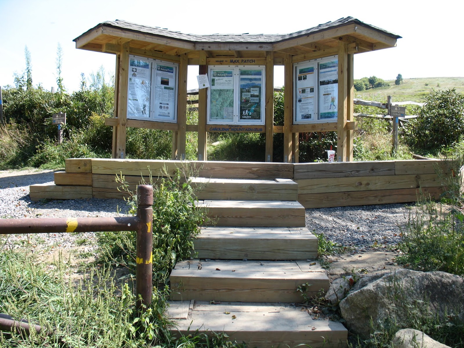
Since our last visit to Max Patch, there has been new signage added. We were hoping to spot the mama elk and her calf on our excursion.


Glancing left along the Smokies range, you can see the triple peaks of Mt LeConte.

We enjoy finding the Geodetic Survey Markers when we explore.

Various areas of the bald were fenced off to protect habitats.

The problem of overuse causing serious erosion was partially addressed by a fence discouraging people from going straight up to the summit.

Some of the most incredible wild flowers grow on or around Max Patch. During the fall there is a spectacular display of gold, purple and white. Ironweed standing majestically over 6 feet tall attracts bees, butterflies and other pollinators.

One of my favorite wildflowers growing below the bald is the gentian. Its pollinator is the bumblebee which has to wiggle and force its way down into the flower.

It's funny to watch a wobbling, wiggling gentian spit out its pollinator, a fat bumblebee.

Gold and Purple, God's created complimentary colors!

Astors galore!

Ironweed and goldenrod!

Solidago, also known as Goldenrod, comes in a white variety. Of the 32 varieties of Goldenrod species found in Tennessee, Silverrod is the only white variety.
By the way, Goldenrods do not cause hay fever. Its pollen is too heavy to be airborne.

Tucked under the trees in the club moss, the Hairy Milk Pea made a showy contrast.

After completing our loop hike across Max Patch, we headed for Wolf Creek Falls. We had hiked 3.5 miles to the falls several years ago, but we started then at the trailhead between Hot Springs, NC and Newport, TN.
It was our first attempt to find the falls from the opposite side. We followed the gravel road down from Max Patch, past Lemon Gap parking area until we came to a sign pointing right to Rattlesnake Gap. This road was much rougher than Max Patch Road! After 1.8 miles, we came to Rattlesnake Gap. At the Gap intersection, we turned right and headed 3 miles down the mountain on a narrow, rocky, rutted road, much worse than most forest service roads we've traveled!

After 3 rough miles, we came to the narrow lane that goes to Wolf Creek Falls. Although we drove a short distance down this tiny rutted lane, we decided to park at a pull-in spot and walk the short distance to the falls.

The falls did not disappoint! Although the area had received little water, the falls were flowing beautifully. If you spot Chris standing on the stone overlook, you can get a better perspective of the size of the falls.

The plunge pool would invite some dipping on a hot day!

The falls were worth every bit of our effort to reach.

The only wildlife we saw was a large black snake sunning amid the gravel in the middle of the road. We stopped to admire the sleek beauty and drove carefully around it.

After our excursion on one side of Pisgah, we headed to Hot Springs hoping to find Upper Shut-in Road which would take us to a newer trail, Betty Place Trail which is a loop trail within a larger loop trail, Bluff Mountain Loop Trail.

Although the information on the kiosk indicated that Betty Place Loop Trail was only a mile long, we measured the loop to be closer to 1.5 miles. The trail is very peaceful following a small stream up to Betty's place and coming down a larger stream.

Actually the trail is a lollipop hike. We chose to go right at the split. Right along the trail we spotted 4 Bearing Trees. Usually there are 3, but this time there were 4. Perhaps one was disqualified since the writing on its tag didn't have information.

The embedded geodetic marker indicated the boundary line.


A sturdy bridge crosses the creek.

A fern-covered rock stood sentinel at the bridge.

Red turtlehead flowers bloomed profusely along the creek banks.


After 0.75 miles of hiking up, up, up, we came to the intersection of the Bluff Mountain Loop Trail. Betty Place Trail veered off to the left across a small brook.

An interesting hand-carved sign marked directions.


We had a glorious day exploring and experiencing God's mountain beauty.
No comments:
Post a Comment